All GEO5 programs communicate with each other via the GeoClipboard, which can be used to transfer large amounts of input data between them - soils, interfaces, project information, various settings, etc.
The programs are also interconnected for related calculations; i.e. a retaining wall from the Gravity Wall program can be immediately checked for global stability in the Slope Stability program, or the bearing capacity of the foundation soil under the wall can be verified with the Spread Footing program. The data from the Slope Stability program can then be sent to the associated Slope Stability – Water Flow module, where the groundwater can be calculated numerically.
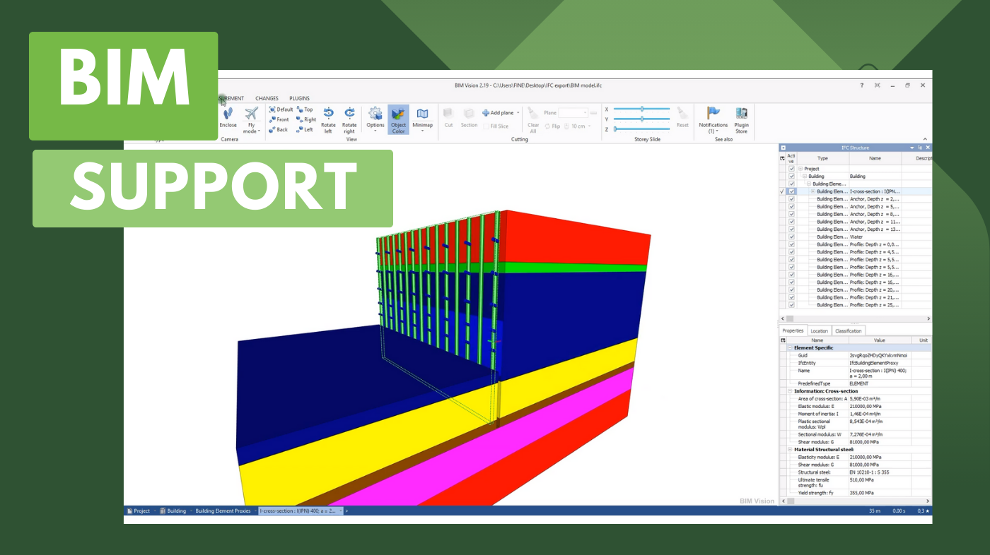
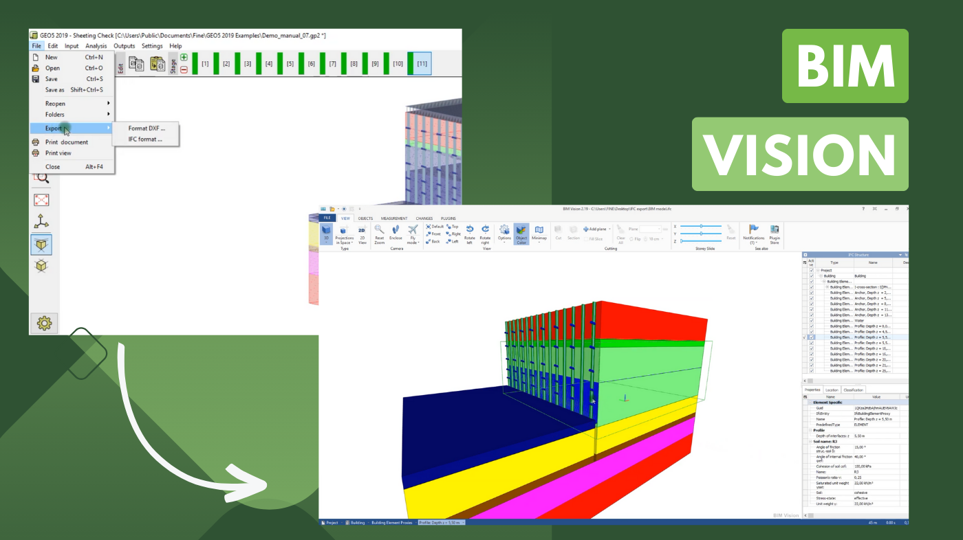
Communication with other programs is solved through many general formats – table data (txt, xls), CAD, IFC, LandXML, and many others. Most of the data can be both exported and imported.
To learn more about data exchange and methods of import/export, click on the link below:
https://www.finesoftware.eu/geotechnical-software/features/data-import-export/